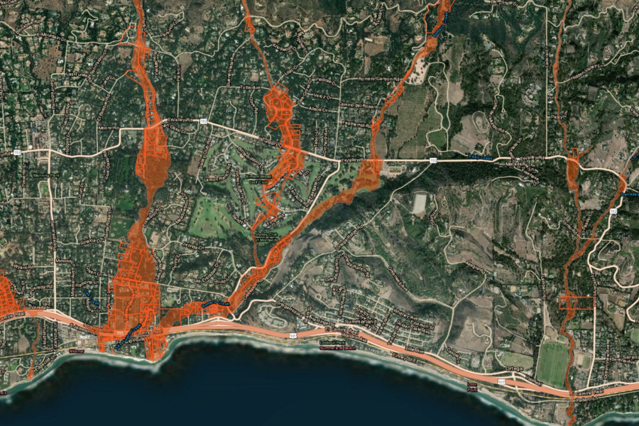
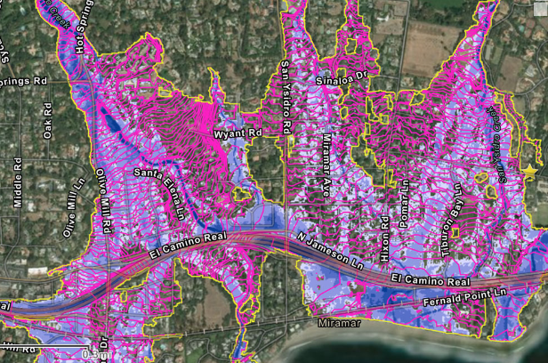
If you’re wondering where the Debris Flow Risk Areas are, the FEMA Map released June 11, 2018, and an interactive Map of Affected Properties click on Santa Barbara Readiness Maps
Santa Barbara Readiness Maps were created for the areas of Montecito, Summerland, and Carpinteria affected by the deadly Jan. 9 debris flows and were released on June 11, 2018, by the Federal Emergency Management Agency. The debris flows killed 23 people and damaged or destroyed hundreds of homes and businesses just weeks after the Thomas Fire blackened most of the watershed about Montecito. The maps reflect areas that can be expected to flood in heavy rainfalls, with new elevations that resulted from the events related to the debris flow, according to Santa Barbara County officials. Residents, architects, and contractors are expected to use the new elevations and flood hazard zones to guide their planning and development decisions.“The maps are a critical guide to future development decisions in Montecito,” said Matt Pontes, the county’s assistant executive officer. “The updated FEMA maps are a key tool to rebuild Montecito.


